PROJECT OVERVIEW AND CHALLENGE
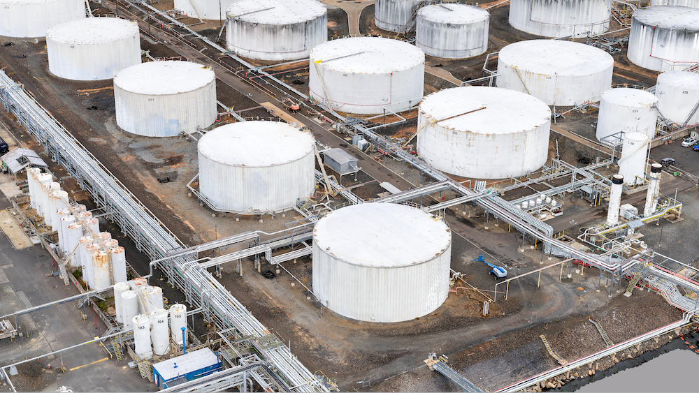
This wetland environmental remediation project is an ongoing, 400+ acre environmental remediation effort along a major navigational channel in the United States. This project was a collaboration between Eye-bot and Sovereign Environmental Group on behalf of an oil and gas supermajor.
The main objective of this project was to provide the Sovereign Environmental team with an accurate 3D drone visualization of over 400 acres and a surface model that combined 4 different areas of interest, all that had been captured at varying times. Particularly, the wetland images were all collected at lunar low tide which only occurs for a few hours each month. This will allow Sovereign to baseline the area at a specific point in time and will allow them to continue to monitor under similar conditions in the future. In the past, images of the area had to be collected at various times that did not show consistent conditions in the study area and were only collected via cell phone imaging.
The 400 acres of data were collected by the Eye-bot team over the course of two, one-week drone surveying and mapping deployments. The team first laid a series of aerial targets that would act as the ground control network for georeferencing the reality model. By utilizing industry leading survey equipment, Eye-Bot confidently ensures that the geospatial accuracy of the data provided and adheres to the ASPRS guidelines set forth for engineering grade aerial captures. After the ground control and control points were set, the team deployed a series of autonomous and manual flights sUAS flights to collect this detailed information. For this project, over 11,000 images were captured during the 2 separate deployments.
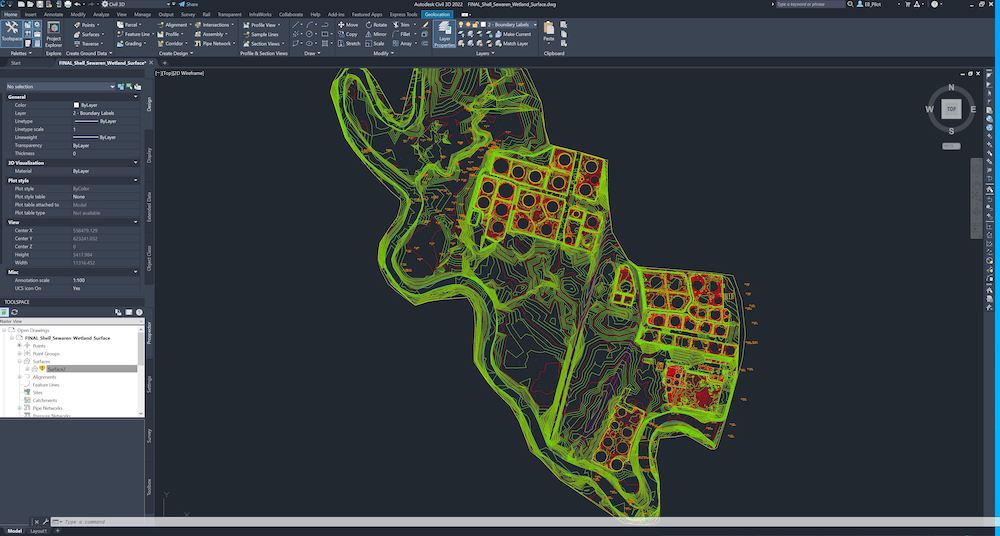
Following the drone mapping and modeling, the Eye-bot team processed a detailed 2D ortho image and 3D mesh model of each area for further consumption and analysis. Also included in the scope of work was the creation of “Enhanced Deliverables” which takes the geospatially accurate digital twin and extracts key insights such as planimetrics/improvements, natural features, and break lines to create an engineering-grade CAD product.
The project outcome would be a cohesive, highly accurate 2D and 3D asset visualization of the wetland and surrounding area that could precisely baseline the project team about the conditions at that time.
Final GSD 2.16 cm/px
Final RMSE (X) = 0.82cm (Y)= 1.16cm (Z)= 4.95cm
This resulting data is now enabling the project team to remotely plan and collaborate with an accurate 3D asset visualization and ingesting the 3D mesh, CAD model, and surface model into various other GIS and engineering software applications. Long term, this data will act as a reliable source of truth to baseline the conditions of each area of interest. The value of this data will continue to compound over time by comparing change over time in future data captures. Future, autonomous drone operations will occur over specific areas to monitor the changes safely and effectively for year to come.

ENVIRONMENTAL IMPACT
Understanding the impact that climate change has had on areas like these wetlands will only continue to improve with the ability to consistently monitor areas using accurate 3D drone visualization. The data that was collected will continue to be used throughout the environmental investigational lifecycle of this site. The reduction in need to travel to the sites will allow Sovereign to review potential future sampling locations without the need to access the wetland site or properties owned by third parties. This will allow them to continue the evaluation with minimal impact or disturbances to surrounding areas. Additionally, this wetland is largely inaccessible on foot due to the dangers presented by slick and unstable surfaces, dense vegetation, and steep terrain. Reducing the time spent performing field investigations is safer and more sustainable.

Eye-Bot’s efforts to create a reality model of this wetland will ensure that 200 acres of protected habitat and all the species that call this wetland home, will be preserved, and even restored. By documenting the effects of erosion, runoff, and flooding remotely and with more accuracy, environmental remediation firms will have a more comprehensive understanding of where to focus their efforts. Accurate benchmark for the current conditions that can now be monitored over time and used to detect changes to the surface that would have never been seen. Eye-Bot also directly eliminated the need for quarterly visits to this site, creating a 75% reduction in the emissions associated with travel. Remote site collaboration also has an ESG impact by reducing scope 3 carbon emissions from eliminating unnecessary flight and vehicle trips.
Eye-Bot’s large-scale photogrammetry data will also help inform the remediation efforts that are focused on eliminating damaging flooding events to the over 100 acres of residential areas that surround this wetland. This ongoing remediation will also benefit the wetland and the water supply of the surrounding area by allowing the team to properly assess the groundwater flow from the nearby facilities and quickly identify any issues that may arise.
This project encapsulates the perfect balance necessary for future sustainability by creating a model in which People, Planet, and Industry are equally represented.
RESULTS DESCRIPTION
Traditional survey methods would have taken weeks to complete this endeavor, and the product would not be as comprehensive as the 3D drone visualization. This alone allowed for a 4x reduction in travel and labor costs. Traditional survey methods also could not have completed this project with the limitations set forth by the changing lunar tides. Reducing risk and increasing collaboration is a key element of company’s digital transformation efforts. The drone surveying and mapping deployed by the Eye-bot team drastically reduced hours spent in the wetland areas and throughout the terminal site effectively reducing risks of slips, trips, and falls presented by time spent in these areas.
Secondary containment volume calculations were also able to be calculated at the terminal, using the top of the lowest containment elevation, and calculated the secondary containment capacities while factoring in the required precipitation accumulation and any volume displacements in accordance with federal and state regulations, specifically N.J.A.C. 7:1E et seq and 40 CFR 112 et seq.

The use of drone mapping and modeling and large-scale photogrammetry to properly digitize the area of interest, has already had a major impact on this project. There has also been significant reduction in unnecessary travel and an increase collaboration and communication that has been made possible using the 3D asset visualization. By digitizing over 400 acres and providing an accurate surface model, the project team will be able to monitor changing conditions better than ever before. The expectation will be to capture this wetland area yearly during similar conditions to better understand the impact that climate change and other environmental impacts are having on the area.

