REMOTE ASSET VISUALIZATION
MAXIMIZING AWARENESS. MINIMIZING EXPOSURE.
Your infrastructure doesn’t stop running between inspections. Your monitoring shouldn’t either.
ON-DEMAND
ASSET PROJECT SECURITY
VISUALIZATION
Your team is accountable for assets that can’t afford a blind spot. Remote Asset Visualization (RAV) gives them continuous visibility, without adding headcount.
Eye-bot’s RAV combines 3D scanning, automated monitoring, and data analytics into a unified deliverable for easy integration with existing operations.
RAV is not just a report you read, it’s a place you navigate through real-time visualization. Your data. Every format. No conditions.

ENABLE REAL-TIMEREMOTE VISUALIZATION
Trusted by top brands around the world
The gap between inspections is where the expensive problems live.
Asset Integrity Managers: Corrosion, thermal anomalies, and mechanical wear don’t follow inspection schedules. The intervals between visits are where failures develop undetected.
Turnaround & Project Controls Teams: As-built documentation and progress verification depend on data that arrives days after site conditions changed. Decisions get made on stale information.
LDAR and Environmental Compliance Teams: OGI surveys cover a fraction of the asset base on a cadence that regulatory requirements are already outpacing. Gaps in coverage become gaps in compliance.
HSSE Managers: Confined space entry, classified zone access, and routine flare inspections put qualified personnel in hazardous areas on a predictable schedule. Reducing that exposure requires removing the crew from the equation.
Emergency Response Coordinators: Aerial situational awareness at an incident only has value if it arrives before command decisions are made, not after.
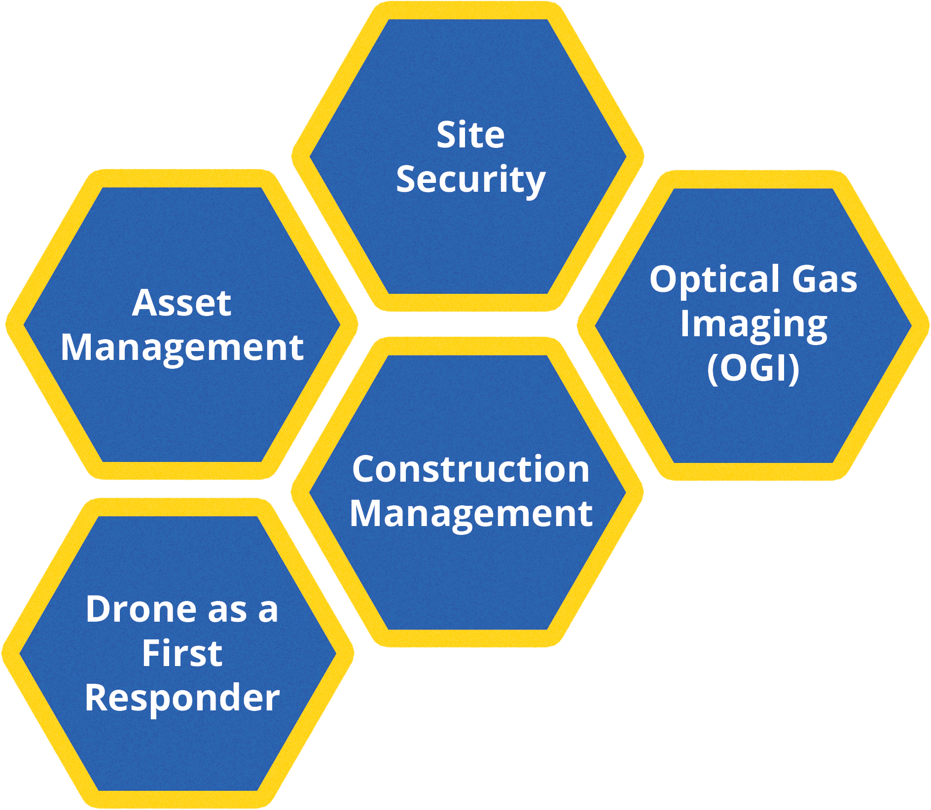
Asset Management
Access real-time livestream video, inspection, and thermal imaging. Share data instantly to make informed decisions and reduce travel expenses.
Benefits:
Reduce travel costs with remote subject matter expert analysis.
Make faster, data-driven decisions.
Prevent asset failure with early detection of mechanical issues.
Improve operational efficiency with continuous monitoring.
Site Security:
Ensure 24/7 autonomous surveillance with RAV’s drones. Reduce the need for on-site personnel and integrate with existing CCTV systems for enhanced security.
Benefits:
Reduce personnel costs with automated monitoring.
Strengthen site security with constant aerial surveillance.
Integrate with existing CCTV systems for enhanced protection.
Minimize human risk in high-security zones.
Construction Management:
Automate tracking and improve safety on-site. Use RAV to monitor progress, track milestones, and streamline project management.
Benefits:
Monitor project progress remotely with real-time data.
Ensure site safety monitoring with automated drone surveillance.
Stay on schedule by tracking milestones.
Easily share updates with project stakeholders.
OGI (Optical Gas Imaging):
Detect and visualize methane, propane, butane, and other hydrocarbon gases in real-time. Keep your operations safe and compliant with cutting-edge gas detection technology.
Benefits:
Identify gas leaks remotely in real-time.
Enhance safety by reducing manual inspections in hazardous areas.
Maintain compliance with regulatory standards effortlessly.
Prevent costly shutdowns by detecting leaks early.
First Responder:
Deploy drones for emergency first response. Provide real-time aerial assessments in hazardous environments, minimizing human risk.
Benefits:
Reduce human exposure in hazardous situations.
Get instant situational awareness during emergencies.
Make informed decisions with real-time visual data.
Speed up response times with autonomous drone deployment.

How It Works
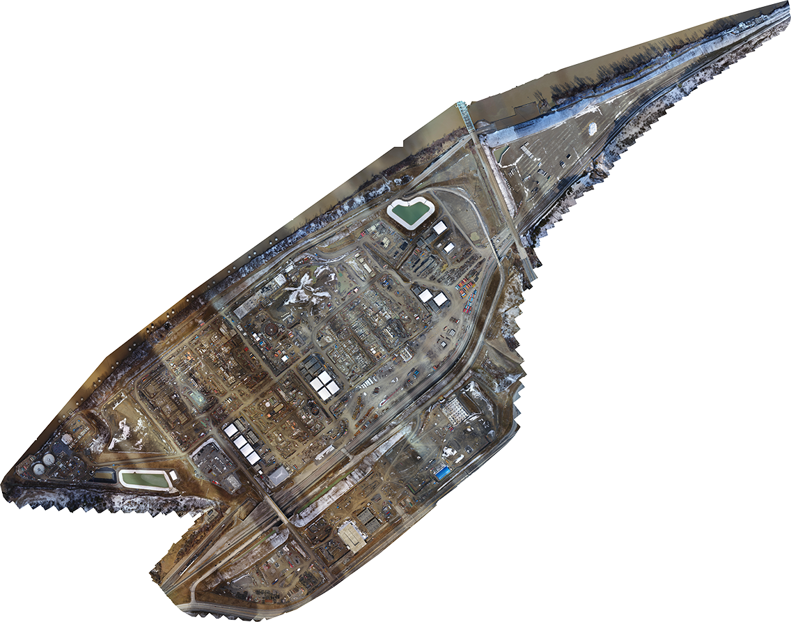
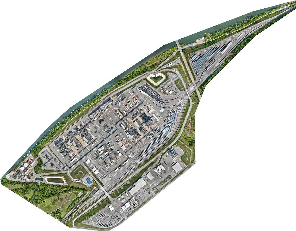
1. 3D Digital foundation
We begin by performing a baseline 3D scan of the site to establish an accurate operational basemap. This basemap is used to support mission planning, obstacle awareness, shielded airspace planning, and repeatable inspection routes.
2. Configuration
Choose from our suite of modules – Asset Management, Construction Monitoring, Gas Detection, and more – to tailor the solution to your requirements.
3. Installation
Our certified technicians install and configure the drone system on-site, ensuring everything is set up for optimal performance.
4. Remote Operation
Eye-bot’s remote pilots deploy automated flights or on-demand missions to capture and deliver crucial data in real-time.
5. visualize
Access your processed data through our secure Visualize platform, with options for advanced 2D and 3D visualizations.
6. Analysis
Real-time AI analysis ensures that your team can assess conditions immediately, enabling faster, data-driven decisions and proactive issue resolution.
What our clients are saying.
Backed by industry leaders - Start your RAV journey today
THE VALUE IS IN OUR EXPERIENCE
- 9Visual Inspections
- 9Thermal Imaging
- 9Gas Detection
- 92D Aerial Surveys
- 93D Modeling
- 9Topographic & Planimetric CAD Drawings
- 9Confined Space Inspections
- 9LiDAR Scanning
RECEIVE A FREE PRICE QUOTE
Why Choose an Autonomous Solution?
Traditional Methods:
Relying on manual inspections means waiting for personnel to arrive, which can delay decisions and increase project risks.
Impact:
These delays affect quality control, slow down collaboration, and prevent you from addressing issues before they escalate.
The Future of Drone Services:
With Eye-bot’s RAV, there’s no more waiting. Automated or remotely piloted drones give you real-time insights, allowing you to share live video with stakeholders worldwide, assess conditions instantly, and make fast, data-driven decisions that improve efficiency and safety.

Ready for On-Demand Insights? Get Started with RAV!
Drop us a note for your free quote and download our RAV catalog today!


The Eye-bot Advantage
Our mission: autonomous aerial operations that give operations teams real-time visibility across distributed assets without the risk of putting crews in the field.
Since 2017, Eye-bot has deployed drone operations in 20+ countries from refineries to geothermal facilities. Our extensive experience in managing large-scale projects has led us to developing an automated solution that meets the unique demands of complex operations. From monitoring expansive projects to managing remote assets, we’ve seen firsthand the value that real-time data can bring to your business.

Jim Yanosick

Jake Lydick

Erik Takach

Chris Dolly
Launching your own drone program?
With over a decade deploying successful drone operations, we have extensive knowledge of what it takes to make a drone operation successful from construction to asset monitoring. We can guide you to making the most of your program from the start while avoiding costly mistakes.
Frequently Asked Questions
What does the Asset Management Module do?
The Asset Management Module covers a wide variety of needs you may have that encompass regulatory needs and daily operational touch points.
For example: You may need to conduct regular flare inspections for regulatory compliance. RAV allows you to schedule those inspections and have the data delivered directly to you, making your compliance tasks easy and predictable.
What if I have a requirement for a specific drone on my site?
We are hardware and software agnostic and choose from the best off the shelf solutions. If you have a specific requirement for hardware, we will seek that out and include it in the implementation of our solution.
What if I don't have a BVLOS waiver?
We have specialists that help you work through the BVLOS process for a seamless integration.
Can I implement more than 1 module on my site?
Yes, we will work with you to understand your needs. Each nest is outfitted for a specific module and multiple boxes can be implemented that complete different tasks.
You get visibility. We handle everything else.
No complex setup or high costs. Eye-bot’s RAV solution makes remote operations simple and affordable.