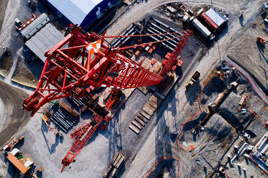
Revolutionizing Land Development with Drone Technology
The adoption of drone technology in land development is revolutionizing the industry by enhancing the accuracy and efficiency of planning and execution phases.
Aerial surveys conducted with drones provide invaluable insights that impact everything from site selection to environmental management.
This technology allows developers to obtain detailed aerial photographs and 3D topography, transforming how lands are developed and managed.
The Advantages of Aerial Surveys in Land Development
Aerial surveys offer several key advantages in land development, including heightened accuracy in data collection, shorter project timelines, and overall cost reduction.
The ability to quickly gather comprehensive data from above means decisions are based on the most current and complete information available. This significantly reduces the risk of costly mistakes and allows adjustments while staying ahead of city/municipal permits.
Detailed Terrain Analysis and Site Assessment
Drones provide detailed information on terrain features, elevation, and conditions critical for effective site assessment.
This data is vital for planning infrastructure, assessing environmental risks, and determining the feasibility of projects.
A comprehensive terrain analysis helps make informed decisions that align with the project’s goals and regulatory standards.
Environmental Impact Assessments
Utilizing drone technology for environmental impact assessments can streamline the process of identifying and evaluating a project’s potential impacts.
Drones can access hard-to-reach areas, identifying sensitive ecosystems and water bodies to help ensure sustainable development practices that comply with environmental regulations.
Infrastructure Planning and Design
In infrastructure planning, aerial insights obtained from drones can drastically enhance the design process.
These surveys help planners visualize how proposed infrastructures, such as roads and utilities, will integrate with the natural landscape, aiding in the optimization of layouts and minimizing ecological disruptions.
Monitoring Construction Progress and Compliance
Drones are crucial in monitoring ongoing construction activities, ensuring that projects adhere to timelines and designs.
Real-time aerial data helps project managers identify discrepancies early, allowing for immediate corrective actions, which keeps projects on track and compliant with regulations.
Land Use Optimization and Management
Aerial surveys support optimal land use by ensuring efficient and effective use of space.
By analyzing drone data, planners can design mixed-use developments, residential areas, and commercial spaces that adhere to zoning laws and community needs, maximizing economic and social returns.
Legal and Regulatory Compliance
Drones provide accurate, detailed mapping to ensure compliance with various legal and regulatory requirements. This is particularly important for boundary delineations and the creation of legal documentation necessary for land development.
Challenges and Considerations in Aerial Surveying
While aerial surveying offers numerous benefits, it also comes with challenges, including privacy concerns, managing airspace regulations, and handling large volumes of data.
Developers must follow best practices in integrating drone technology into their projects, addressing these issues to maximize benefits while minimizing potential drawbacks.
Eye-bot’s Expertise in Aerial Surveys for Land Development
Aerial surveys have significantly impacted modern land development. By providing detailed and accurate data quickly and efficiently, drone technology helps save time and resources while enhancing the overall quality of projects.
This transformative technology is shaping the future of land development, providing developers with the tools they need to achieve better results faster and at a lower cost.
For land developers looking to integrate sophisticated aerial survey techniques into their projects, embracing drone technology offers a pathway to more precise and efficient development.
This approach streamlines processes and improves outcomes, making it an essential tool in modern land development.
If you’re ready to transform your land development projects with the precision and efficiency of aerial survey technology, Eye-bot is here to help.
Connect with us today to explore how our advanced drone solutions can enhance your planning, execution, and monitoring processes. Take the first step towards smarter, faster, and more cost-effective land development.
Contact Eye-bot for a consultation and see what aerial insights can do for you.

