Many industries require surveyors to provide maps of property lines, the topography of the land, locations of structures, and improvements whether existing or proposed.
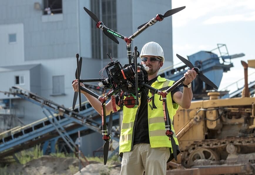
Eye-bot’s team of licensed surveyors are measuring and mapping this data during the preliminary (existing conditions or pre-construction), construction, and as-built phases throughout the lifecycle of our projects and delivering high-definition, 3D interactive maps with survey-grade accuracies. From a land developer and home builder to an oil and gas capital asset manager and project owner, who uses Unmanned Aerial Systems (UAS) for land surveying has no boundaries. A number of industries are advancing with UAS surveying and mapping.
Safer, Faster, Easier with UAS Mapping
We are making surveying jobs safer, faster and easier using hundreds and thousands of images that are strategically captured across the project area to deliver a fully integrated, interactive, precise, and accurate 3D representation of the project area for our clients.
From establishing initial project control to creating detailed, high-definition, visual 3D digital maps of every square foot of the visible surface, improvements, property corners, property lines, buildings, utilities, interiors, and underground facilities. Eye-bot develops true “digital twins” of the projects being mapped. Incorporating these new innovations in 3D mapping and drone surveying methodologies and techniques, projects become more cost-effective and efficient, while at the same time delivering a true, visual representation of the project area.
Industries Advancing with UAS Surveying and Mapping
Among the many industries implementing these advanced innovations in UAV and mobile mapping, some of the most significant include:
- Land Development: Whether for residential or commercial land development, with a drone, it is possible to carry out highly accurate topographic surveys but in a fraction of the time as compared to traditional methods. This substantially reduces the cost of a site survey and the workload of specialists in the field. Eye-bot’s team of licensed surveyors, experienced FAA Part 107 certified commercial pilots and technicians ensure the accuracy through detailed, high-definition, interactive, 3D digital maps of every square foot to develop true “digital twins” of the projects we survey
- Construction & Infrastructure: There are numerous use cases of how drones are used in construction. Companies need surveyors to start almost any project, but they especially require their help on large-scale builds. For example, establishing boundaries, creating subdivisions, the topography and locations of existing conditions, and evaluating the suitability of the land before beginning any project. With the provided information, construction companies can make important preliminary decisions that ensure optimal safety and legality for the project.
- Oil and Gas: The installation of oil and gas pipelines requires a significant amount of planning. Inspecting a capital asset is critical. UAS or drone surveys help these companies evaluate where pipelines can and can’t go, whether it’s due to proximity to natural resources and conservation sites, preexisting construction or infrastructure, or privately owned property. With 3D digital maps, and a cloud-based platform, like geoXD, it’s easy to collaborate, measure, and annotate.
- Mining: Quarries and open mines can be dangerous areas for surveyors using conventional surveying methods and techniques, but mining companies often need a mapping of their worksites. UAS provides an excellent way of capturing aerial images and creating 3D Digital Surface Models for volumetric calculations while keeping their surveyors as safe as possible.
- Transportation When it comes to designing, constructing, or inspecting roads and bridges, stakeholders need to know the details of the infrastructure and surrounding land. UAS imaging can help them take detailed examinations of the areas of interest. It can be the foundation for virtual reality simulations and interactive 3D visualizations to provide information for public outreach and feedback on new projects.
3D Property Lines and Boundary Survey
While maintaining the integrity of traditional surveying practices, we deliver more data and information faster and less expensive while adhering to the importance of survey-grade accuracies. At Eye-bot, we are integrating the latest in advanced UAS and conventional measuring technologies in the air, on the ground, and below the surface.
For more information about how we can integrate UAS Surveying & Mapping into any Drone Program across numerous industries,
please contact us today.