Drone 3D Asset Visualization is changing how companies:
Collaborate
Manage Safety
Plan
Reduce unnecessary travel
Monitor Changes
Communicate
Identify Issues
Train and on-board
Are you approaching your bids the old-fashioned way?
Still relying on outdated satellite imagery?
Still having contractors visit sites to produce bids?
Still using outdated 2D drawings to plan?
WHY?

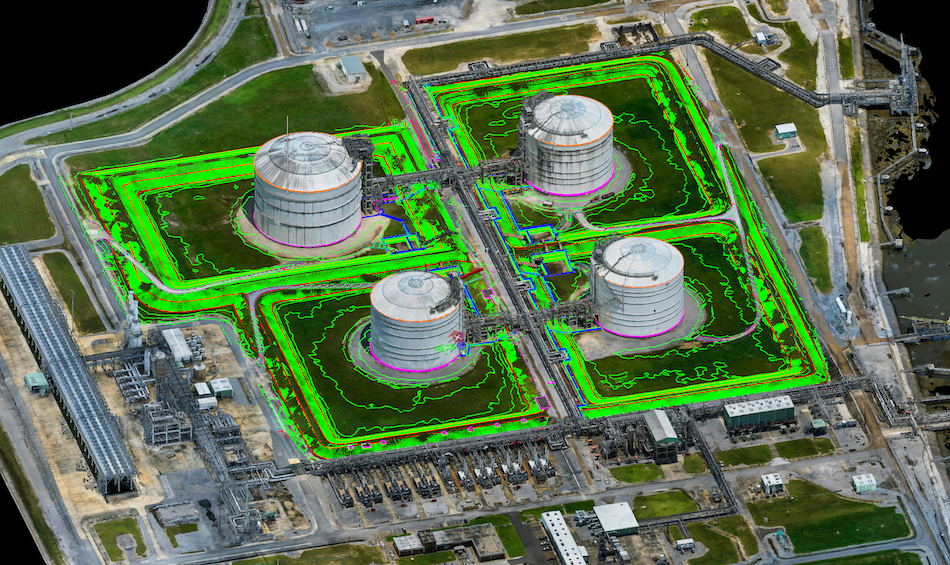
As-built 3D Drone Model overlayed with a 3D topographic map
Are you spending more money than you should?
Unnecessary travel costs continue to burden companies and affect the environment. Eye-bot’s proprietary approach to 3D Drone Asset Visualization allows companies to benefit from our advanced methods of data collection and data processing to visualize most sites in less than a week. Our team can cover hundreds of acres per day to produce 3D Asset Visualization models viewable from a computer in less than 1 week!

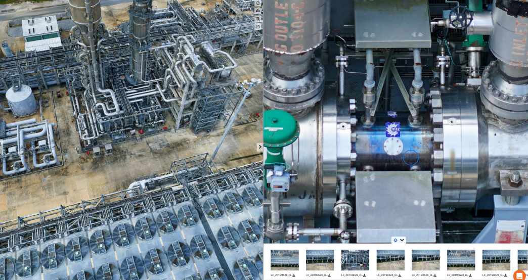
3D Drone Visualization model with access to original drone images
Did You Know?
3D Asset Visualization provides project stakeholders a better understanding of the as-built conditions of the site. Eye-bot’s 3D Drone Asset Visualization allows for better identification of potential conflicts and/or errors in design compared to traditional 2d plans. Contact us today to learn more!
Our team specializes in 3D Drone Visualization of assets around the world
Leveraging our years of experience capturing a weekly 3D Asset Visualization of a multi-billion-dollar construction site has positioned us as leaders in the space of 3D Drone Asset Visualization. The efficiencies developed by our team reduces risk and increases ROI.
Inaccurate, inconsistent data costs time and money. Eye-bot delivers 3D Drone Asset Visualization services for every phase of construction and asset lifecycle monitoring. When you work with Eye-bot, you work with the best industry professionals. And it is through our Drone 3d Design and Visualization services that we enable better collaboration between architects, engineers, general contractors, and the project owners. Whether you seek high resolution cm accurate 3D drone visualization or a 3d Topographic map of your site, our team of industry experts deliver what you need to be successful.
New boundary and topographic solutions
Under the direct supervision of a Licensed Professional Surveyor, the Eye-bot team delivers advanced 3D mapping and modeling solutions for boundary and topographic surveys on any project, small or large. We are saving our clients both time and money when compared to conventional surveying methodologies alone.

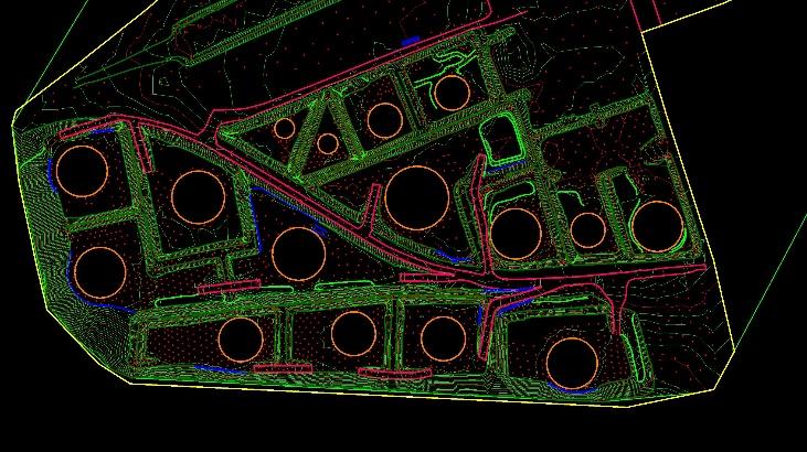
3D topographic map extracted from a 3D drone visualization model
Did You Know?
3D Asset Visualization provides project stakeholders a better understanding of the as-built conditions of the site. Eye-bot’s 3D Drone Asset Visualization allows for better identification of potential conflicts and/or errors in design compared to traditional 2d plans. Contact us today to learn more!
Our team specializes in 3D Drone Visualization of assets around the world
Leveraging our years of experience capturing a weekly 3D Asset Visualization of a multi-billion-dollar construction site has positioned us as leaders in the space of 3D Drone Asset Visualization. The efficiencies developed by our team reduces risk and increases ROI.
Inaccurate, inconsistent data costs time and money. Eye-bot delivers 3D Drone Asset Visualization services for every phase of construction and asset lifecycle monitoring. When you work with Eye-bot, you work with the best industry professionals. And it is through our Drone 3d Design and Visualization services that we enable better collaboration between architects, engineers, general contractors, and the project owners. Whether you seek high resolution cm accurate 3D drone visualization or a 3d Topographic map of your site, our team of industry experts deliver what you need to be successful.
Interior 3D asset visualization
Our team also specializes in interior 3D asset visualization for where a drone can’t see from the air. Companies are realizing significant benefit from Eye-bot’s combined 3D Laser Scanning and Drone Services. Early stages of site documentation and conceptualization, to monitoring construction progress and verifying as-built accuracy, our detailed data will provide your team with complete digital records of any site, regardless of size.

Featured Case Study
Learn how Hayes Design Group leveraged Eye-bot’s 3D Asset Visualization services to develop site plans after a storm damaged a 100+ year old church.
3D Asset Visualization Just Got Easier!
Ready to get started?
